


Le Bourgnon

Gegetop
User

Length
6.3 km

Max alt
813 m

Uphill gradient
143 m
Km-Effort
8.2 km

Min alt
718 m

Downhill gradient
143 m
Boucle
Yes
Creation date :
2014-12-10 00:00:00.0
Updated on :
2014-12-10 00:00:00.0
1h35
Difficulty : Unknown

FREE GPS app for hiking
 SityTrail
IGN / Geographical institutes
SityTrail Plus
The world is yours!
About
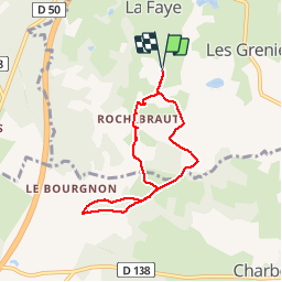
Trail Walking of 6.3 km to be discovered at Auvergne-Rhône-Alpes, Puy-de-Dôme, Loubeyrat. This trail is proposed by Gegetop.
Positioning
Country:
France
Region :
Auvergne-Rhône-Alpes
Department/Province :
Puy-de-Dôme
Municipality :
Loubeyrat
Location:
Unknown
Start:(Dec)
Start:(UTM)
498342 ; 5086341 (31T) N.
Comments
facile. le parcours n'est cependant pas très sexy.