


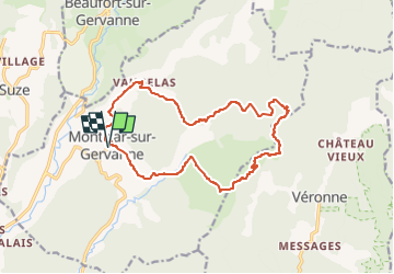
Montclar sur Gervanne-Col Gerbe-Chple St Christophe 17km

thonyc
User GUIDE

Length
16.6 km

Max alt
702 m

Uphill gradient
559 m
Km-Effort
24 km

Min alt
317 m

Downhill gradient
560 m
Boucle
Yes
Creation date :
2023-03-12 10:09:13.13
Updated on :
2023-03-22 07:07:36.597
5h20
Difficulty : Medium

FREE GPS app for hiking
 SityTrail
IGN / Geographical institutes
SityTrail Plus
The world is yours!
About
Trail Walking of 16.6 km to be discovered at Auvergne-Rhône-Alpes, Drôme, Montclar-sur-Gervanne. This trail is proposed by thonyc.
Description
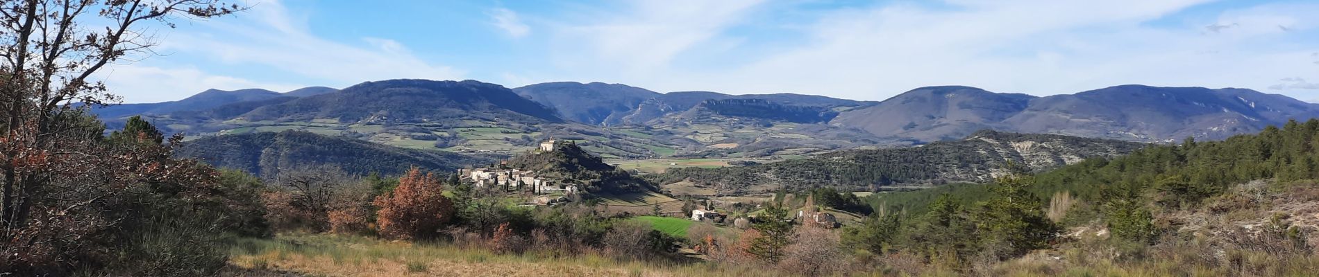
Jolis villages, ne pas hésiter à monter jusqu'à l'église St Marcel, vues magnifiques sur la vallée de La Gervanne, le synclinal de St pancrace et la faille géologique de Gigors.
Photos


Positioning
Country:
France
Region :
Auvergne-Rhône-Alpes
Department/Province :
Drôme
Municipality :
Montclar-sur-Gervanne
Location:
Unknown
Start:(Dec)
Start:(UTM)
669618 ; 4957043 (31T) N.
Comments