


st André-13-03-23

papou73
User
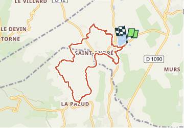

Length
8.6 km

Max alt
484 m

Uphill gradient
219 m
Km-Effort
11.5 km

Min alt
288 m

Downhill gradient
220 m
Boucle
Yes
Creation date :
2023-03-13 12:31:13.021
Updated on :
2023-03-13 15:01:40.226
2h29
Difficulty : Medium

FREE GPS app for hiking
 SityTrail
IGN / Geographical institutes
SityTrail Plus
The world is yours!
About
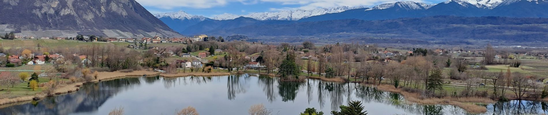
Trail Walking of 8.6 km to be discovered at Auvergne-Rhône-Alpes, Savoy, Porte-de-Savoie. This trail is proposed by papou73.
Photos

Positioning
Country:
France
Region :
Auvergne-Rhône-Alpes
Department/Province :
Savoy
Municipality :
Porte-de-Savoie
Location:
Les Marches
Start:(Dec)
Start:(UTM)
733416 ; 5042061 (31T) N.
Comments