


pré Peyret - Vallon de Combeau

Atchoum26
User
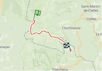

Length
14.8 km

Max alt
1844 m

Uphill gradient
406 m
Km-Effort
21 km

Min alt
1423 m

Downhill gradient
585 m
Boucle
No
Creation date :
2023-03-05 06:22:15.714
Updated on :
2023-03-14 09:36:41.019
4h49
Difficulty : Medium

FREE GPS app for hiking
 SityTrail
IGN / Geographical institutes
SityTrail Plus
The world is yours!
About
Trail Walking of 14.8 km to be discovered at Auvergne-Rhône-Alpes, Isère, Gresse-en-Vercors. This trail is proposed by Atchoum26.
Description
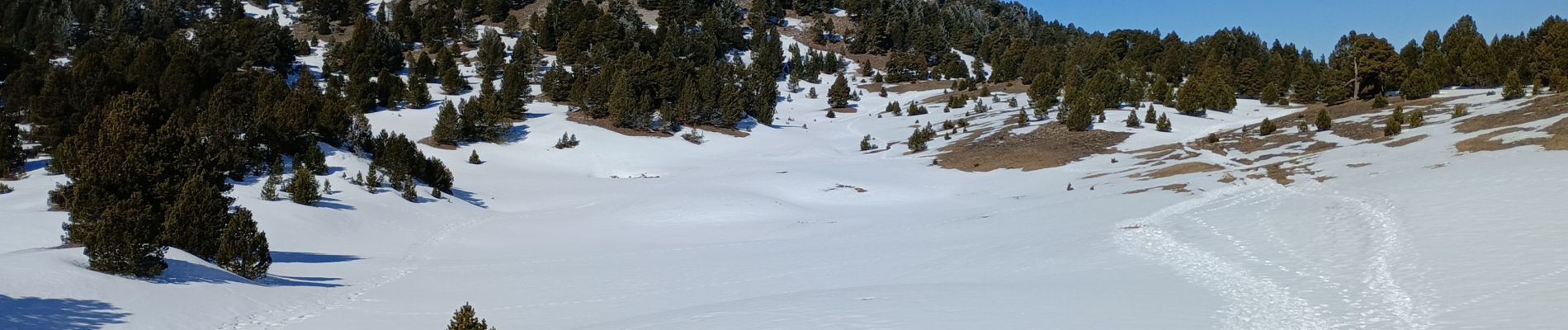
passage à Chaumailloux
Photos


Positioning
Country:
France
Region :
Auvergne-Rhône-Alpes
Department/Province :
Isère
Municipality :
Gresse-en-Vercors
Location:
Unknown
Start:(Dec)
Start:(UTM)
696280 ; 4966706 (31T) N.
Comments