


col saint pierre

labarone
User
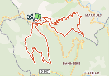

Length
19.3 km

Max alt
677 m

Uphill gradient
868 m
Km-Effort
31 km

Min alt
258 m

Downhill gradient
872 m
Boucle
Yes
Creation date :
2023-03-14 08:27:25.115
Updated on :
2023-03-14 15:48:19.626
7h19
Difficulty : Difficult

FREE GPS app for hiking
 SityTrail
IGN / Geographical institutes
SityTrail Plus
The world is yours!
About
Trail Walking of 19.3 km to be discovered at Occitania, Gard, Saint-Jean-du-Gard. This trail is proposed by labarone.
Description
des côtes ..des cailloux et des feuilles
Positioning
Country:
France
Region :
Occitania
Department/Province :
Gard
Municipality :
Saint-Jean-du-Gard
Location:
Unknown
Start:(Dec)
Start:(UTM)
567154 ; 4887231 (31T) N.
Comments