


Rando 4L

jojo02
User

Length
88 km

Max alt
184 m

Uphill gradient
1036 m
Km-Effort
102 km

Min alt
36 m

Downhill gradient
1036 m
Boucle
Yes
Creation date :
2023-03-17 13:34:44.0
Updated on :
2023-03-17 17:53:32.31
4h16
Difficulty : Easy

FREE GPS app for hiking
 SityTrail
IGN / Geographical institutes
SityTrail Plus
The world is yours!
About
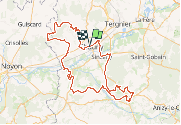
Trail 4x4 of 88 km to be discovered at Hauts-de-France, Aisne, Chauny. This trail is proposed by jojo02.
Positioning
Country:
France
Region :
Hauts-de-France
Department/Province :
Aisne
Municipality :
Chauny
Location:
Unknown
Start:(Dec)
Start:(UTM)
515550 ; 5496032 (31U) N.
Comments