


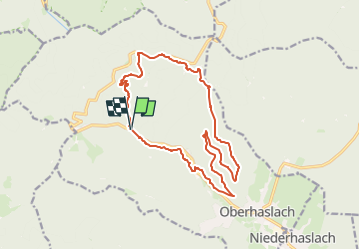
Cascade du Nideck-modifiée

geranimo
User

Length
16.4 km

Max alt
644 m

Uphill gradient
647 m
Km-Effort
25 km

Min alt
298 m

Downhill gradient
644 m
Boucle
Yes
Creation date :
2023-03-20 18:01:13.412
Updated on :
2023-03-20 18:02:21.017
5h41
Difficulty : Difficult

FREE GPS app for hiking
 SityTrail
IGN / Geographical institutes
SityTrail Plus
The world is yours!
About
Trail Walking of 16.4 km to be discovered at Grand Est, Bas-Rhin, Oberhaslach. This trail is proposed by geranimo.
Positioning
Country:
France
Region :
Grand Est
Department/Province :
Bas-Rhin
Municipality :
Oberhaslach
Location:
Unknown
Start:(Dec)
Start:(UTM)
373593 ; 5380960 (32U) N.
Comments