


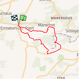
ERMETON-sur-BIERT

GerardBouche
User

Length
10.9 km

Max alt
294 m

Uphill gradient
213 m
Km-Effort
13.8 km

Min alt
199 m

Downhill gradient
212 m
Boucle
Yes
Creation date :
2014-12-10 00:00:00.0
Updated on :
2014-12-10 00:00:00.0
2h00
Difficulty : Easy

FREE GPS app for hiking
 SityTrail
IGN / Geographical institutes
SityTrail Plus
The world is yours!
About
Trail Walking of 10.9 km to be discovered at Wallonia, Namur, Mettet. This trail is proposed by GerardBouche.
Description
Très agréable balade par la Campagne de Stache->le Bois Gilles->La Haie Motte et l'Abbaye de Maredret.
Positioning
Country:
Belgium
Region :
Wallonia
Department/Province :
Namur
Municipality :
Mettet
Location:
Ermeton-sur-Biert
Start:(Dec)
Start:(UTM)
622652 ; 5573371 (31U) N.
Comments
Attention en début de rando, un sentier envahi par de hautes orties. C'est la nature ! Nous étions en short, nous avons fait un petit détour. SUPERBE aaprès-midi. Merci Gérard.