


st louis les bitches

fredodlageo
User
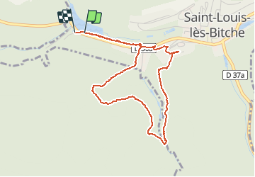

Length
4.4 km

Max alt
370 m

Uphill gradient
114 m
Km-Effort
6 km

Min alt
269 m

Downhill gradient
116 m
Boucle
Yes
Creation date :
2014-12-10 00:00:00.0
Updated on :
2014-12-10 00:00:00.0
51m
Difficulty : Medium

FREE GPS app for hiking
 SityTrail
IGN / Geographical institutes
SityTrail Plus
The world is yours!
About
Trail Walking of 4.4 km to be discovered at Grand Est, Moselle, Saint-Louis-lès-Bitche. This trail is proposed by fredodlageo.
Description
20141024
Positioning
Country:
France
Region :
Grand Est
Department/Province :
Moselle
Municipality :
Saint-Louis-lès-Bitche
Location:
Unknown
Start:(Dec)
Start:(UTM)
378549 ; 5427415 (32U) N.
Comments