


voie verte hypodrome

fredtruc27
User

Length
2 km

Max alt
73 m

Uphill gradient
8 m
Km-Effort
2.2 km

Min alt
64 m

Downhill gradient
11 m
Boucle
No
Creation date :
2023-03-24 16:00:18.439
Updated on :
2023-03-24 16:00:20.132
8m
Difficulty : Easy

FREE GPS app for hiking
 SityTrail
IGN / Geographical institutes
SityTrail Plus
The world is yours!
About
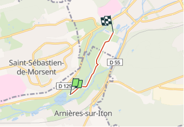
Trail Mountain bike of 2 km to be discovered at Normandy, Eure, Arnières-sur-Iton. This trail is proposed by fredtruc27.
Positioning
Country:
France
Region :
Normandy
Department/Province :
Eure
Municipality :
Arnières-sur-Iton
Location:
Unknown
Start:(Dec)
Start:(UTM)
361075 ; 5429273 (31U) N.
Comments