


Gaujac 160323

fario
User
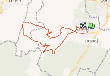

Length
11 km

Max alt
280 m

Uphill gradient
247 m
Km-Effort
14.3 km

Min alt
114 m

Downhill gradient
248 m
Boucle
Yes
Creation date :
2023-03-16 08:15:46.237
Updated on :
2023-04-05 14:35:11.361
3h15
Difficulty : Difficult

FREE GPS app for hiking
 SityTrail
IGN / Geographical institutes
SityTrail Plus
The world is yours!
About
Trail Walking of 11 km to be discovered at Occitania, Gard, Gaujac. This trail is proposed by fario.
Description
Rando toujours aussi sympa avec l'Oppidum de Gaujac, la chappelle St Saturnin et la visite de Gaujac .
Photos


Positioning
Country:
France
Region :
Occitania
Department/Province :
Gard
Municipality :
Gaujac
Location:
Unknown
Start:(Dec)
Start:(UTM)
626598 ; 4881707 (31T) N.
Comments