


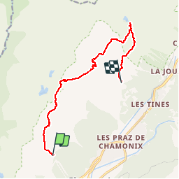
Chamonix Bob G... Planpraz.. lac Cornu..lac Blanc...La Flégère

r.genette
User

Length
11.8 km

Max alt
2494 m

Uphill gradient
787 m
Km-Effort
23 km

Min alt
1871 m

Downhill gradient
904 m
Boucle
No
Creation date :
2015-05-01 00:00:00.0
Updated on :
2015-05-01 00:00:00.0
6h00
Difficulty : Difficult

FREE GPS app for hiking
 SityTrail
IGN / Geographical institutes
SityTrail Plus
The world is yours!
About
Trail Walking of 11.8 km to be discovered at Auvergne-Rhône-Alpes, Upper Savoy, Chamonix-Mont-Blanc. This trail is proposed by r.genette.
Description
Départ depuis Planpraz et retour par La Flégère en passant par les lacs Cornu et Blanc
Positioning
Country:
France
Region :
Auvergne-Rhône-Alpes
Department/Province :
Upper Savoy
Municipality :
Chamonix-Mont-Blanc
Location:
Unknown
Start:(Dec)
Start:(UTM)
333555 ; 5089156 (32T) N.
Comments