


Pourchères Ajoux

Monjean
User

Length
16.5 km

Max alt
865 m

Uphill gradient
726 m
Km-Effort
26 km

Min alt
514 m

Downhill gradient
725 m
Boucle
Yes
Creation date :
2023-04-04 07:59:15.445
Updated on :
2023-04-05 07:41:02.548
6h34
Difficulty : Very difficult

FREE GPS app for hiking
 SityTrail
IGN / Geographical institutes
SityTrail Plus
The world is yours!
About
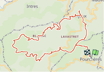
Trail Walking of 16.5 km to be discovered at Auvergne-Rhône-Alpes, Ardèche, Pourchères. This trail is proposed by Monjean.
Description
Beaux sentiers d'Ardèche. paysages variés
Positioning
Country:
France
Region :
Auvergne-Rhône-Alpes
Department/Province :
Ardèche
Municipality :
Pourchères
Location:
Unknown
Start:(Dec)
Start:(UTM)
619254 ; 4955924 (31T) N.
Comments