


Combovin 1

raygautier
User
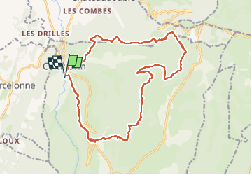

Length
20 km

Max alt
969 m

Uphill gradient
1072 m
Km-Effort
35 km

Min alt
365 m

Downhill gradient
1073 m
Boucle
Yes
Creation date :
2023-04-05 07:36:53.0
Updated on :
2023-04-05 15:08:27.701
7h30
Difficulty : Very difficult

FREE GPS app for hiking
 SityTrail
IGN / Geographical institutes
SityTrail Plus
The world is yours!
About
Trail Walking of 20 km to be discovered at Auvergne-Rhône-Alpes, Drôme, Combovin. This trail is proposed by raygautier.
Positioning
Country:
France
Region :
Auvergne-Rhône-Alpes
Department/Province :
Drôme
Municipality :
Combovin
Location:
Unknown
Start:(Dec)
Start:(UTM)
664085 ; 4970767 (31T) N.
Comments