


L’ussas

raygautier
User
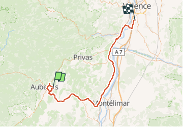

Length
97 km

Max alt
368 m

Uphill gradient
1015 m
Km-Effort
111 km

Min alt
63 m

Downhill gradient
1219 m
Boucle
No
Creation date :
2023-04-09 08:39:18.0
Updated on :
2023-04-09 20:08:31.102
4h46
Difficulty : Medium

FREE GPS app for hiking
 SityTrail
IGN / Geographical institutes
SityTrail Plus
The world is yours!
About
Trail Walking of 97 km to be discovered at Auvergne-Rhône-Alpes, Ardèche, Lussas. This trail is proposed by raygautier.
Positioning
Country:
France
Region :
Auvergne-Rhône-Alpes
Department/Province :
Ardèche
Municipality :
Lussas
Location:
Unknown
Start:(Dec)
Start:(UTM)
614326 ; 4941098 (31T) N.
Comments