


2023-04-10_13h33m26_Trace-356-SaintPierredeCaubel-2022

Francinedu
User
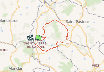

Length
12.2 km

Max alt
208 m

Uphill gradient
255 m
Km-Effort
15.6 km

Min alt
75 m

Downhill gradient
255 m
Boucle
Yes
Creation date :
2023-04-10 11:33:26.166
Updated on :
2023-04-24 15:30:16.157

FREE GPS app for hiking
 SityTrail
IGN / Geographical institutes
SityTrail Plus
The world is yours!
About
Trail of 12.2 km to be discovered at New Aquitaine, Lot-et-Garonne, Pinel-Hauterive. This trail is proposed by Francinedu.
Positioning
Country:
France
Region :
New Aquitaine
Department/Province :
Lot-et-Garonne
Municipality :
Pinel-Hauterive
Location:
Unknown
Start:(Dec)
Start:(UTM)
305035 ; 4926804 (31T) N.
Comments