


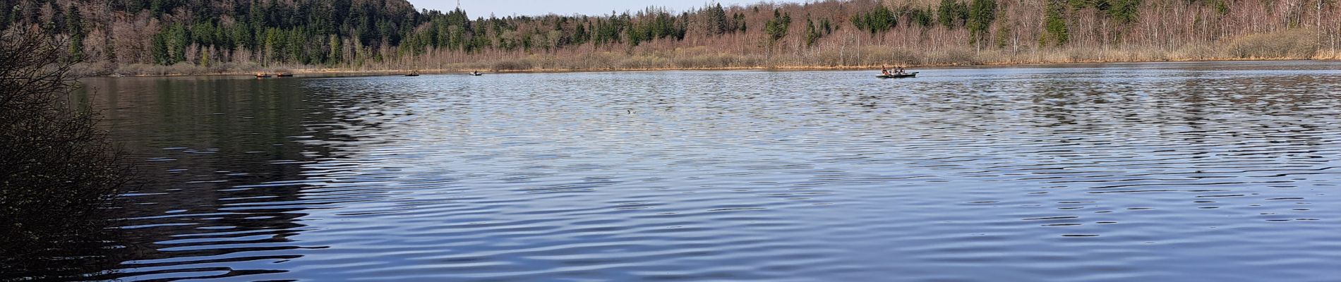
Tour du lac de Bonlieu et le marais

micheldutilleul
User
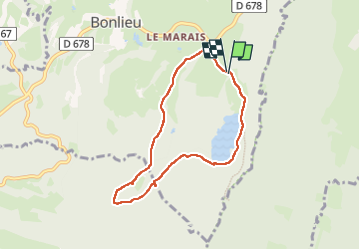

Length
6.6 km

Max alt
861 m

Uphill gradient
112 m
Km-Effort
8.1 km

Min alt
788 m

Downhill gradient
116 m
Boucle
Yes
Creation date :
2023-04-10 08:38:02.243
Updated on :
2023-04-12 13:12:35.352
3h19
Difficulty : Very easy

FREE GPS app for hiking
 SityTrail
IGN / Geographical institutes
SityTrail Plus
The world is yours!
About
Trail Walking of 6.6 km to be discovered at Bourgogne-Franche-Comté, Jura, Bonlieu. This trail is proposed by micheldutilleul.
Photos

Positioning
Country:
France
Region :
Bourgogne-Franche-Comté
Department/Province :
Jura
Municipality :
Bonlieu
Location:
Unknown
Start:(Dec)
Start:(UTM)
720121 ; 5164081 (31T) N.
Comments