


81-Lacaune - le Pic des Ecus

Jovila
User
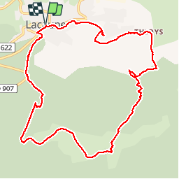

Length
12.6 km

Max alt
1162 m

Uphill gradient
466 m
Km-Effort
18.8 km

Min alt
797 m

Downhill gradient
467 m
Boucle
Yes
Creation date :
2015-04-16 00:00:00.0
Updated on :
2015-04-16 00:00:00.0
3h40
Difficulty : Medium

FREE GPS app for hiking
 SityTrail
IGN / Geographical institutes
SityTrail Plus
The world is yours!
About
Trail Walking of 12.6 km to be discovered at Occitania, Tarn, Lacaune. This trail is proposed by Jovila.
Positioning
Country:
France
Region :
Occitania
Department/Province :
Tarn
Municipality :
Lacaune
Location:
Unknown
Start:(Dec)
Start:(UTM)
475108 ; 4839377 (31T) N.
Comments
Super