


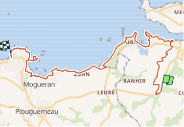
2-Guissény-Plouguerneau 20km

thonyc
User GUIDE

Length
20 km

Max alt
56 m

Uphill gradient
203 m
Km-Effort
23 km

Min alt
-1 m

Downhill gradient
220 m
Boucle
No
Creation date :
2023-04-13 15:11:17.405
Updated on :
2023-06-15 16:17:47.491
5h11
Difficulty : Very difficult

FREE GPS app for hiking
 SityTrail
IGN / Geographical institutes
SityTrail Plus
The world is yours!
About
Trail Walking of 20 km to be discovered at Brittany, Finistère, Guissény. This trail is proposed by thonyc.
Positioning
Country:
France
Region :
Brittany
Department/Province :
Finistère
Municipality :
Guissény
Location:
Unknown
Start:(Dec)
Start:(UTM)
395115 ; 5385680 (30U) N.
Comments