


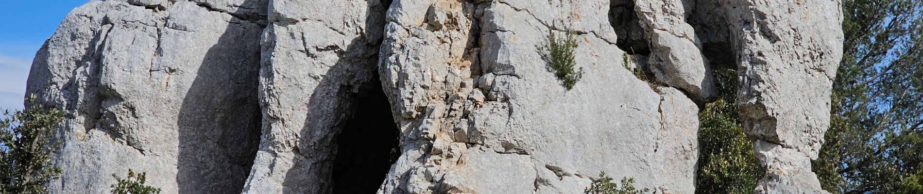
Signes - L'éléphant de pierre

Sigmut
User
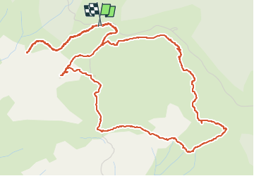

Length
8.3 km

Max alt
692 m

Uphill gradient
188 m
Km-Effort
10.8 km

Min alt
582 m

Downhill gradient
186 m
Boucle
Yes
Creation date :
2023-04-14 10:35:28.125
Updated on :
2023-04-25 12:06:34.461
2h49
Difficulty : Easy

FREE GPS app for hiking
 SityTrail
IGN / Geographical institutes
SityTrail Plus
The world is yours!
About
Trail Walking of 8.3 km to be discovered at Provence-Alpes-Côte d'Azur, Var, Signes. This trail is proposed by Sigmut.
Description
Randonnée effectuée avec des enfants de 7 et 6 ans.
Photos


30 photos in total. Please click on a photo to see them all in the gallery.
Positioning
Country:
France
Region :
Provence-Alpes-Côte d'Azur
Department/Province :
Var
Municipality :
Signes
Location:
Unknown
Start:(Dec)
Start:(UTM)
735350 ; 4790916 (31T) N.
Comments