


Teilhede

Gegetop
User
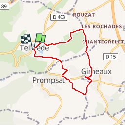

Length
6.5 km

Max alt
525 m

Uphill gradient
167 m
Km-Effort
8.7 km

Min alt
372 m

Downhill gradient
169 m
Boucle
Yes
Creation date :
2014-12-10 00:00:00.0
Updated on :
2014-12-10 00:00:00.0
1h38
Difficulty : Easy

FREE GPS app for hiking
 SityTrail
IGN / Geographical institutes
SityTrail Plus
The world is yours!
About
Trail Walking of 6.5 km to be discovered at Auvergne-Rhône-Alpes, Puy-de-Dôme, Teilhède. This trail is proposed by Gegetop.
Description
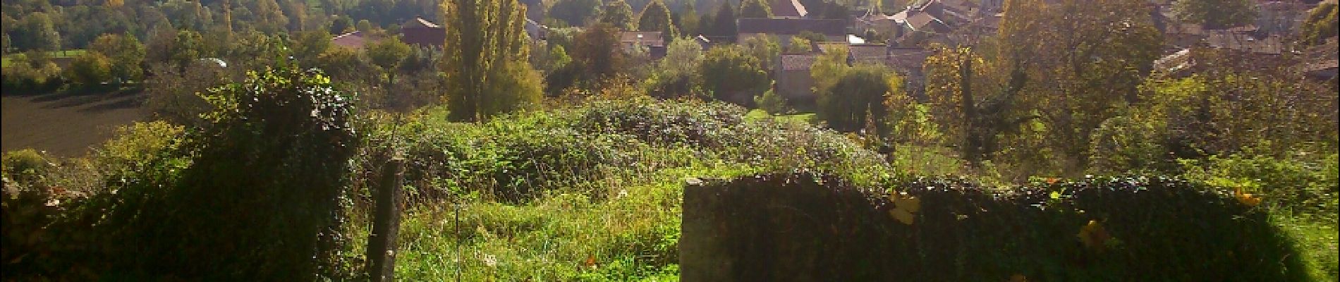
Petite balade sympa avec joli point de vue depuis le Puy de Montaury.
Photos


Positioning
Country:
France
Region :
Auvergne-Rhône-Alpes
Department/Province :
Puy-de-Dôme
Municipality :
Teilhède
Location:
Unknown
Start:(Dec)
Start:(UTM)
505611 ; 5089195 (31T) N.
Comments
bien