


20230415

fredodlageo
User

Length
4.1 km

Max alt
566 m

Uphill gradient
153 m
Km-Effort
6.1 km

Min alt
469 m

Downhill gradient
146 m
Boucle
Yes
Creation date :
2023-04-15 13:06:23.0
Updated on :
2023-04-17 09:47:47.688
1h16
Difficulty : Medium

FREE GPS app for hiking
 SityTrail
IGN / Geographical institutes
SityTrail Plus
The world is yours!
About
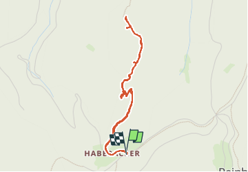
Trail Walking of 4.1 km to be discovered at Grand Est, Bas-Rhin, Reinhardsmunster. This trail is proposed by fredodlageo.
Description
Rando Izzie,Alexie
Positioning
Country:
France
Region :
Grand Est
Department/Province :
Bas-Rhin
Municipality :
Reinhardsmunster
Location:
Unknown
Start:(Dec)
Start:(UTM)
374888 ; 5393088 (32U) N.
Comments