


Le roc nantais

labarone
User

Length
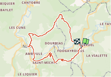
22 km

Max alt
861 m

Uphill gradient
730 m
Km-Effort
32 km

Min alt
474 m

Downhill gradient
731 m
Boucle
Yes
Creation date :
2023-04-18 06:57:47.828
Updated on :
2023-04-18 14:46:28.401
7h07
Difficulty : Medium

FREE GPS app for hiking
 SityTrail
IGN / Geographical institutes
SityTrail Plus
The world is yours!
About
Trail Walking of 22 km to be discovered at Occitania, Aveyron, Saint-Jean-du-Bruel. This trail is proposed by labarone.
Description
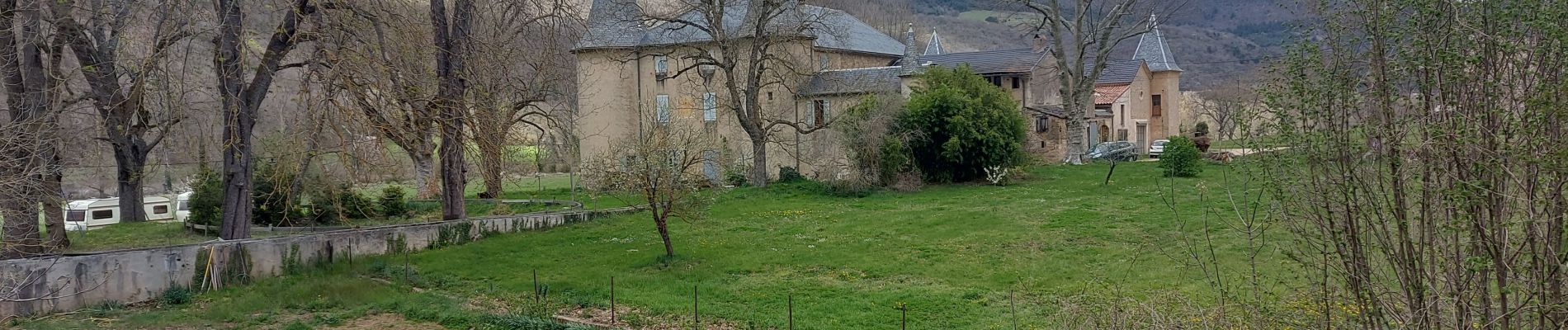
belle rando
Photos


Positioning
Country:
France
Region :
Occitania
Department/Province :
Aveyron
Municipality :
Saint-Jean-du-Bruel
Location:
Unknown
Start:(Dec)
Start:(UTM)
529021 ; 4874256 (31T) N.
Comments