


Venet_150423

d.rognon
User
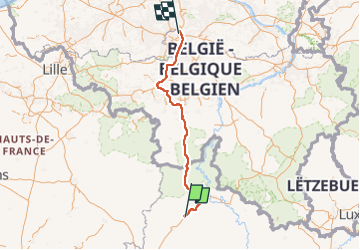

Length
194 km

Max alt
384 m

Uphill gradient
2672 m
Km-Effort
230 km

Min alt
20 m

Downhill gradient
2793 m
Boucle
No
Creation date :
2023-04-15 13:59:52.313
Updated on :
2023-04-22 15:30:07.693
2h12
Difficulty : Easy

FREE GPS app for hiking
 SityTrail
IGN / Geographical institutes
SityTrail Plus
The world is yours!
About
Trail Car of 194 km to be discovered at Grand Est, Ardennes, Saulces-Monclin. This trail is proposed by d.rognon.
Positioning
Country:
France
Region :
Grand Est
Department/Province :
Ardennes
Municipality :
Saulces-Monclin
Location:
Unknown
Start:(Dec)
Start:(UTM)
608682 ; 5494506 (31U) N.
Comments