Trail Walking Hannut - Tracé - Photo
 jipysn
jipysn

User

© OpenStreetMap contributors
Length
Length
6.3 km
Max alt
Max alt
113 m
Uphill gradient
Uphill gradient
64 m
Km-Effort
Km-Effort  
7.1 km
Min alt
Min alt
73 m
Downhill gradient
Downhill gradient
64 m
Boucle
Boucle
Yes
Creation date :
2023-04-23 06:11:08.367
Updated on :
2024-01-14 11:00:03.015

(1 Reviews)

Walking
Walking
1h37
Difficulty : Medium

Scan this QR Code to open this trail in the SityTrail application

FREE GPS app for hiking

Logo SityTrail SityTrail

IGN / Geographical institutes

Download SityTrail from the App Store Download SityTrail from Google Play

Logo SityTrail SityTrail World

The world is yours!

Download SityTrail from the App Store Download SityTrail from Google Play Download SityTrail on Huawei AppGallery

About

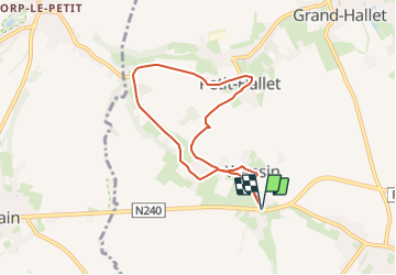
Trail Walking of 6.3 km to be discovered at Wallonia, Liège, Hannut. This trail is proposed by jipysn.

Description

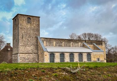
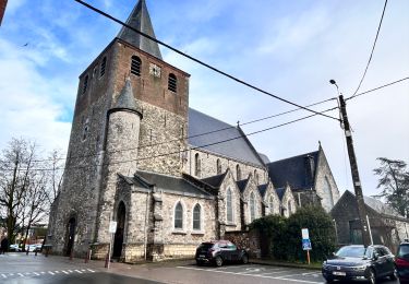
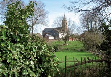
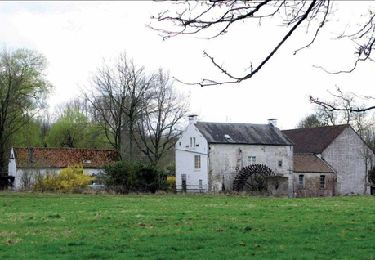
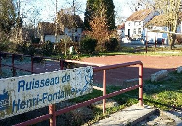
"Wansin et Petit-Hallet sont deux petites bourgades au relief assez accusé.  Les ruisseaux qui les traversent ont creusé leur lit dans les craies crétacées.  Il existait dans les deux localités de véritables mines où l'on extrayait la marne afin d'amender les champs en calcaire. C'est dans ces caves qu'a pris naissance, dès le milieu du 19e siècle, la culture des champignons. Aujourd'hui la plupart des caves se sont éboulées. La dernière qui subsiste, à Wansin, avait une longueur de 4 km. A l'heure actuelle il n'y a plus guère qu'une galerie de 150 m. qui soit accessible.  
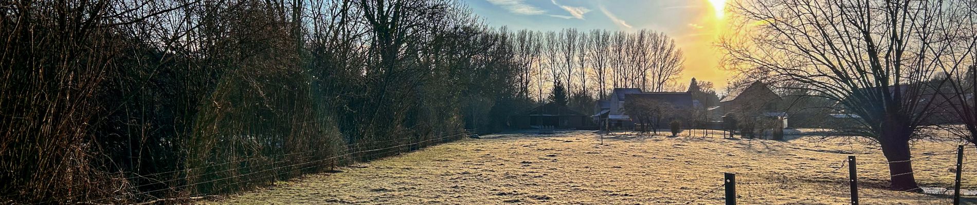
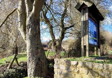
Nous vous proposons de découvrir deux des plus jolis villages de la région. La découverte ne sera pas seulement celle des paysages, du patrimoine et de l'histoire locale: les deux villages recèlent en effet une flore d'une très grande richesse.

Source: www.hannut.be

Elevation profile

Photos

Positioning

Country:
Belgium
Region :
Wallonia
Department/Province :
Liège
Municipality :
Hannut
Location:
Unknown
Start:(UTM)
642860 ; 5615611 (31U) N.

Comments

Please log in to post a review or rate the element


Trails nearby

Trail Walking Orp-Jauche - RB-BW-01 - Raccourci  1- L'Extrême-Orient du Brabant wallon - Photo
Walking
PRO

Walking

Medium
(2)
Orp-Jauche, Wallonia, Walloon Brabant, Belgium
20 km | 23 km-effort
5h 46min
Yes
Trail Walking Orp-Jauche - RB-Bw-01 - Orp-le-Grand via la variante - Photo
Walking
PRO

Walking

Medium
(2)
Orp-Jauche, Wallonia, Walloon Brabant, Belgium
25 km | 29 km-effort
6h 30min
Yes
Trail Walking Orp-Jauche - RB-BW-01 - Raccourci  2- L'Extrême-Orient du Brabant wallon - Photo
Walking
PRO

Walking

Medium
(3)
Orp-Jauche, Wallonia, Walloon Brabant, Belgium
17.2 km | 19.4 km-effort
4h 31min
Yes
Trail Walking Orp-Jauche - Orp le Grand Nathalie Demain 29 11 2016 - Photo
Walking
ThierryGABRIEL

Walking

Easy
(3)
Orp-Jauche, Wallonia, Walloon Brabant, Belgium
16.6 km | 18.9 km-effort
6h 52min
Yes
Trail Walking Hannut - La promenade de la Mouhagne  - Photo
Walking
GUIDE+

Walking

Medium
(1)
Hannut, Wallonia, Liège, Belgium
7.9 km | 9 km-effort
2h 3min
Yes
Trail Walking Orp-Jauche - w-belgie-grottenwandeling - Photo
Walking
gpstracks

Walking

Very easy
(2)
Orp-Jauche, Wallonia, Walloon Brabant, Belgium
9.6 km | 11.2 km-effort
Unknown
Yes
Trail Walking Orp-Jauche - Orp jauche - Photo
Walking
cello1954

Walking

Very easy
(1)
Orp-Jauche, Wallonia, Walloon Brabant, Belgium
12.5 km | 14.5 km-effort
2h 26min
Yes
Trail Walking Lincent - Tracé - Photo
Walking
jipysn

Walking

Very easy
Lincent, Wallonia, Liège, Belgium
5.7 km | 6.4 km-effort
1h 27min
Yes
Trail Walking Hannut - Hannut R3 - Photo
Walking
jipysn

Walking

Easy
Hannut, Wallonia, Liège, Belgium
8.4 km | 9 km-effort
2h 2min
Yes


Close
My subscriptions