


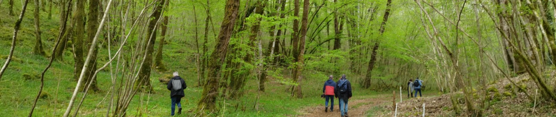
La randonnée de l'ail des ours de Bunzac.

alainjoseph6
User
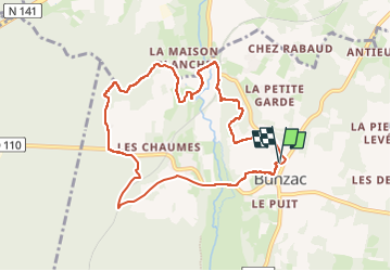

Length
9.3 km

Max alt
120 m

Uphill gradient
124 m
Km-Effort
10.9 km

Min alt
79 m

Downhill gradient
123 m
Boucle
Yes
Creation date :
2023-04-23 07:47:36.163
Updated on :
2024-04-09 06:26:01.71
2h28
Difficulty : Medium

FREE GPS app for hiking
 SityTrail
IGN / Geographical institutes
SityTrail Plus
The world is yours!
About
Trail Walking of 9.3 km to be discovered at New Aquitaine, Charente, Bunzac. This trail is proposed by alainjoseph6.
Description
Une super 👍 randonnée à découvrir absolument. Vous pouvez voir le gouffre de chez Roby,les jonquilles sauvage au printemps, une vallée avec l'ail des ours, du muguet en mai.
Photos


Positioning
Country:
France
Region :
New Aquitaine
Department/Province :
Charente
Municipality :
Bunzac
Location:
Unknown
Start:(Dec)
Start:(UTM)
293826 ; 5064399 (31T) N.
Comments
rando sympa mais porte mal sont nom 0 je dit bien 0 ail des ours trouver