


2023-04-24_17h35m47_Circuit_vigne_et_canaux

Titinechris
User
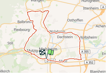

Length
39 km

Max alt
299 m

Uphill gradient
352 m
Km-Effort
43 km

Min alt
153 m

Downhill gradient
350 m
Boucle
Yes
Creation date :
2023-04-24 15:35:47.795
Updated on :
2023-04-24 15:35:49.105

FREE GPS app for hiking
 SityTrail
IGN / Geographical institutes
SityTrail Plus
The world is yours!
About
Trail of 39 km to be discovered at Grand Est, Bas-Rhin, Dorlisheim. This trail is proposed by Titinechris.
Positioning
Country:
France
Region :
Grand Est
Department/Province :
Bas-Rhin
Municipality :
Dorlisheim
Location:
Unknown
Start:(Dec)
Start:(UTM)
388473 ; 5375951 (32U) N.
Comments