


2023-04-24 Rando Villiers le Bâcle

jchezlemas
User
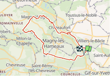

Length
18 km

Max alt
177 m

Uphill gradient
246 m
Km-Effort
21 km

Min alt
84 m

Downhill gradient
253 m
Boucle
Yes
Creation date :
2023-04-24 07:12:44.332
Updated on :
2023-04-24 16:42:15.228
4h02
Difficulty : Easy

FREE GPS app for hiking
 SityTrail
IGN / Geographical institutes
SityTrail Plus
The world is yours!
About
Trail Walking of 18 km to be discovered at Ile-de-France, Essonne, Villiers-le-Bâcle. This trail is proposed by jchezlemas.
Positioning
Country:
France
Region :
Ile-de-France
Department/Province :
Essonne
Municipality :
Villiers-le-Bâcle
Location:
Unknown
Start:(Dec)
Start:(UTM)
435118 ; 5396153 (31U) N.
Comments