


2023-04-26_18h33m35_Vallee-noireau

Olivier.d
User

Length
14.1 km

Max alt
202 m

Uphill gradient
364 m
Km-Effort
19 km

Min alt
47 m

Downhill gradient
363 m
Boucle
Yes
Creation date :
2023-04-26 16:33:36.107
Updated on :
2023-04-26 16:33:37.569

FREE GPS app for hiking
 SityTrail
IGN / Geographical institutes
SityTrail Plus
The world is yours!
About
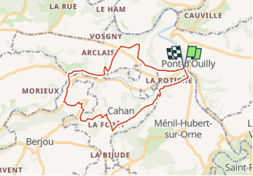
Trail of 14.1 km to be discovered at Normandy, Calvados, Pont-d'Ouilly. This trail is proposed by Olivier.d.
Positioning
Country:
France
Region :
Normandy
Department/Province :
Calvados
Municipality :
Pont-d'Ouilly
Location:
Unknown
Start:(Dec)
Start:(UTM)
689786 ; 5416519 (30U) N.
Comments