


valvestire

Dupuybadonniere
User
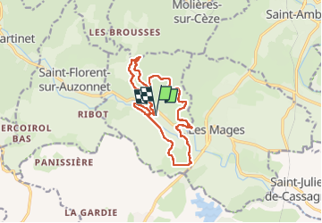

Length
14.1 km

Max alt
462 m

Uphill gradient
430 m
Km-Effort
19.9 km

Min alt
191 m

Downhill gradient
433 m
Boucle
Yes
Creation date :
2023-04-23 07:49:21.345
Updated on :
2023-04-30 14:07:22.967
3h46
Difficulty : Very easy

FREE GPS app for hiking
 SityTrail
IGN / Geographical institutes
SityTrail Plus
The world is yours!
About
Trail Walking of 14.1 km to be discovered at Occitania, Gard, Saint-Jean-de-Valériscle. This trail is proposed by Dupuybadonniere.
Positioning
Country:
France
Region :
Occitania
Department/Province :
Gard
Municipality :
Saint-Jean-de-Valériscle
Location:
Unknown
Start:(Dec)
Start:(UTM)
591295 ; 4898275 (31T) N.
Comments