


cordes

BeaGuy
User
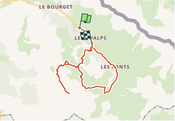

Length
19.2 km

Max alt
3060 m

Uphill gradient
1375 m
Km-Effort
37 km

Min alt
1925 m

Downhill gradient
1340 m
Boucle
No
Creation date :
2022-06-26 04:35:21.764
Updated on :
2023-04-30 17:41:27.335
8h14
Difficulty : Very difficult

FREE GPS app for hiking
 SityTrail
IGN / Geographical institutes
SityTrail Plus
The world is yours!
About
Trail Walking of 19.2 km to be discovered at Provence-Alpes-Côte d'Azur, Hautes-Alpes, Cervières. This trail is proposed by BeaGuy.
Positioning
Country:
France
Region :
Provence-Alpes-Côte d'Azur
Department/Province :
Hautes-Alpes
Municipality :
Cervières
Location:
Unknown
Start:(Dec)
Start:(UTM)
325482 ; 4970183 (32T) N.
Comments