


SityTrail - 3617242 - rando-cancerille-14-mai-2023-by-dal

giovannoni
User
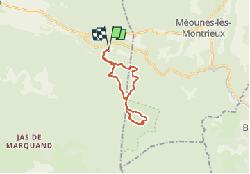

Length
11 km

Max alt
531 m

Uphill gradient
346 m
Km-Effort
15.6 km

Min alt
292 m

Downhill gradient
349 m
Boucle
Yes
Creation date :
2023-05-01 11:46:12.0
Updated on :
2023-05-01 11:46:13.676

FREE GPS app for hiking
 SityTrail
IGN / Geographical institutes
SityTrail Plus
The world is yours!
About
Trail of 11 km to be discovered at Provence-Alpes-Côte d'Azur, Var, Signes. This trail is proposed by giovannoni.
Positioning
Country:
France
Region :
Provence-Alpes-Côte d'Azur
Department/Province :
Var
Municipality :
Signes
Location:
Unknown
Start:(Dec)
Start:(UTM)
737242 ; 4795331 (31T) N.
Comments