


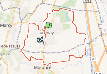
lucenay morance

Jean-Marc C
User

Length
12.1 km

Max alt
312 m

Uphill gradient
177 m
Km-Effort
14.4 km

Min alt
171 m

Downhill gradient
174 m
Boucle
No
Creation date :
2023-05-04 06:57:34.388
Updated on :
2023-05-04 10:12:15.282
3h08
Difficulty : Difficult

FREE GPS app for hiking
 SityTrail
IGN / Geographical institutes
SityTrail Plus
The world is yours!
About
Trail Walking of 12.1 km to be discovered at Auvergne-Rhône-Alpes, Rhône, Lucenay. This trail is proposed by Jean-Marc C.
Positioning
Country:
France
Region :
Auvergne-Rhône-Alpes
Department/Province :
Rhône
Municipality :
Lucenay
Location:
Unknown
Start:(Dec)
Start:(UTM)
631926 ; 5085703 (31T) N.
Comments