Trail Walking Chastreix - Chastreix - Photo
 v.rabot
v.rabot

User

© OpenStreetMap contributors
Length
Length
12.9 km
Max alt
Max alt
1214 m
Uphill gradient
Uphill gradient
300 m
Km-Effort
Km-Effort  
16.8 km
Min alt
Min alt
1030 m
Downhill gradient
Downhill gradient
297 m
Boucle
Boucle
Yes
Creation date :
2023-05-04 10:06:20.974
Updated on :
2023-05-06 16:47:29.439

(0 Reviews)

Walking
Walking
3h49
Difficulty : Difficult

Scan this QR Code to open this trail in the SityTrail application

FREE GPS app for hiking

Logo SityTrail SityTrail

IGN / Geographical institutes

Download SityTrail from the App Store Download SityTrail from Google Play

Logo SityTrail SityTrail World

The world is yours!

Download SityTrail from the App Store Download SityTrail from Google Play Download SityTrail on Huawei AppGallery

About

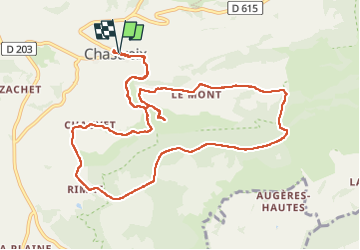
Trail Walking of 12.9 km to be discovered at Auvergne-Rhône-Alpes, Puy-de-Dôme, Chastreix. This trail is proposed by v.rabot.

Description

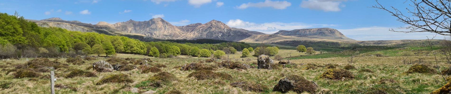
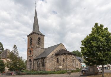
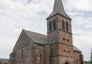
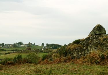
Partant de l'église de Chastreix, on rejoint sans difficulté la réserve naturelle et le bois de la Masse qui offrira un peu d'ombre en été. Début mai est une excellente saison pour profiter pleinement de la nature, les verts des arbres et les prairies jonchées de narcisses.
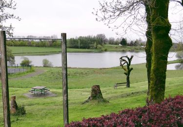
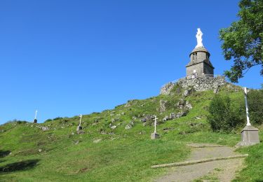
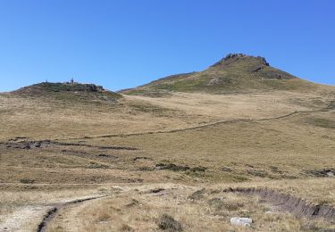
Passage à la cascade des essrats qui offrira un petit coin de fraîcheur et une table de pique-nique. Puis retour à Chastreix sans oublier de visiter l'église. Plussieurs tables de pique-nique sont disponibles sur le point de vue. Parcours sans difficulté, réalisé en 4h16 avec de nombreuses pauses photos ou repas.

Elevation profile

Photos

Positioning

Country:
France
Region :
Auvergne-Rhône-Alpes
Department/Province :
Puy-de-Dôme
Municipality :
Chastreix
Location:
Unknown
Start:(UTM)
479283 ; 5039897 (31T) N.

Trails nearby

Trail Walking La Tour-d'Auvergne - Tour_Auvergne_Chambourguet - Photo
Walking
GUIDE
jagarnier

Walking

Difficult
(1)
La Tour-d'Auvergne, Auvergne-Rhône-Alpes, Puy-de-Dôme, France
17.7 km | 24 km-effort
5h 0min
Yes
Trail Walking Chastreix - Chastreix. cascades et tourbières  - Photo
Walking
olivier78000

Walking

Easy
(1)
Chastreix, Auvergne-Rhône-Alpes, Puy-de-Dôme, France
13.8 km | 18.3 km-effort
4h 5min
Yes
Trail On foot La Tour-d'Auvergne - Chambourguet - Photo
On foot
PRO

On foot

Medium
La Tour-d'Auvergne, Auvergne-Rhône-Alpes, Puy-de-Dôme, France
16.8 km | 23 km-effort
5h 17min
Yes
Trail On foot Saint-Donat - Bertinet - Photo
On foot
PRO

On foot

Easy
Saint-Donat, Auvergne-Rhône-Alpes, Puy-de-Dôme, France
7.9 km | 10 km-effort
2h 15min
Yes
Trail On foot Chastreix - Bois de la Masse - Photo
On foot
PRO

On foot

Easy
Chastreix, Auvergne-Rhône-Alpes, Puy-de-Dôme, France
12.2 km | 16.2 km-effort
3h 40min
Yes
Trail On foot La Tour-d'Auvergne - Notre Dame de Natzy - Photo
On foot
PRO

On foot

Easy
La Tour-d'Auvergne, Auvergne-Rhône-Alpes, Puy-de-Dôme, France
4.1 km | 5.8 km-effort
1h 19min
No
Trail On foot Chastreix - Chastreix+la réserve_Bois_dela_Masse - Photo
On foot
v.rabot

On foot

Easy
(1)
Chastreix, Auvergne-Rhône-Alpes, Puy-de-Dôme, France
9 km | 12.4 km-effort
2h 48min
Yes
Trail Walking Chastreix - boucle de la fontaine salée  - Photo
Walking
la gane

Walking

Medium
Chastreix, Auvergne-Rhône-Alpes, Puy-de-Dôme, France
9.1 km | 12 km-effort
2h 55min
Yes
Trail Walking Saint-Donat - St_Donat_Bertinet - Photo
Walking
GUIDE
jagarnier

Walking

Easy
Saint-Donat, Auvergne-Rhône-Alpes, Puy-de-Dôme, France
9.3 km | 12.1 km-effort
2h 45min
Yes


Close
My subscriptions