


Romeyer

raygautier
User
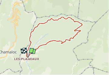

Length
17.8 km

Max alt
1492 m

Uphill gradient
1045 m
Km-Effort
32 km

Min alt
560 m

Downhill gradient
1042 m
Boucle
Yes
Creation date :
2023-05-04 06:47:11.0
Updated on :
2023-05-04 18:21:12.151
8h26
Difficulty : Very difficult

FREE GPS app for hiking
 SityTrail
IGN / Geographical institutes
SityTrail Plus
The world is yours!
About
Trail Walking of 17.8 km to be discovered at Auvergne-Rhône-Alpes, Drôme, Romeyer. This trail is proposed by raygautier.
Positioning
Country:
France
Region :
Auvergne-Rhône-Alpes
Department/Province :
Drôme
Municipality :
Romeyer
Location:
Unknown
Start:(Dec)
Start:(UTM)
690450 ; 4962907 (31T) N.
Comments