


Rando Gairngorm

jeanmarcMasson
User GUIDE
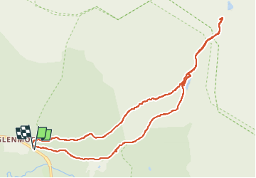

Length
8.5 km

Max alt
429 m

Uphill gradient
173 m
Km-Effort
10.8 km

Min alt
332 m

Downhill gradient
171 m
Boucle
Yes
Creation date :
2023-05-02 07:28:41.876
Updated on :
2023-05-06 07:58:56.935
2h01
Difficulty : Very easy

FREE GPS app for hiking
 SityTrail
IGN / Geographical institutes
SityTrail Plus
The world is yours!
About
Trail Walking of 8.5 km to be discovered at Scotland, Highland. This trail is proposed by jeanmarcMasson.
Positioning
Country:
United Kingdom
Region :
Scotland
Department/Province :
Highland
Municipality :
Unknown
Location:
Unknown
Start:(Dec)
Start:(UTM)
458197 ; 6336131 (30V) N.
Comments