


Le lac.des plages le chalet du covillet

jeanic63
User

Length
13.8 km

Max alt
1739 m

Uphill gradient
678 m
Km-Effort
23 km

Min alt
1180 m

Downhill gradient
678 m
Boucle
Yes
Creation date :
2023-05-08 08:07:24.634
Updated on :
2023-05-08 14:10:20.909
5h27
Difficulty : Very difficult

FREE GPS app for hiking
 SityTrail
IGN / Geographical institutes
SityTrail Plus
The world is yours!
About
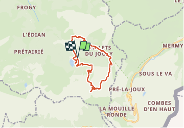
Trail Walking of 13.8 km to be discovered at Auvergne-Rhône-Alpes, Upper Savoy, Abondance. This trail is proposed by jeanic63.
Description
départ lac des plagnes
Positioning
Country:
France
Region :
Auvergne-Rhône-Alpes
Department/Province :
Upper Savoy
Municipality :
Abondance
Location:
Unknown
Start:(Dec)
Start:(UTM)
326956 ; 5124044 (32T) N.
Comments