


baguenaudage en Avignon

stef789
User GUIDE
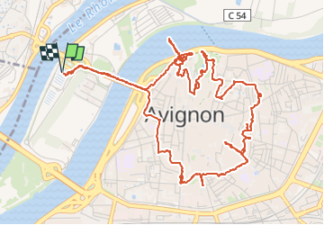

Length
8.4 km

Max alt
56 m

Uphill gradient
78 m
Km-Effort
9.4 km

Min alt
17 m

Downhill gradient
77 m
Boucle
Yes
Creation date :
2023-05-09 12:30:57.333
Updated on :
2023-05-09 16:40:16.915
4h08
Difficulty : Very easy

FREE GPS app for hiking
 SityTrail
IGN / Geographical institutes
SityTrail Plus
The world is yours!
About
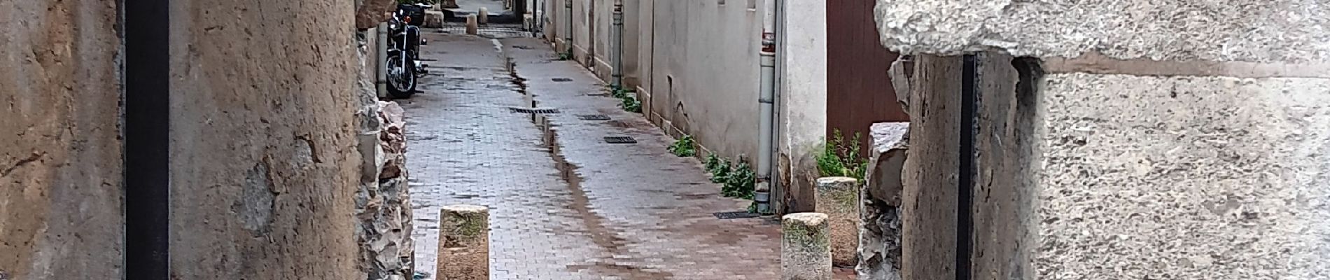
Trail Walking of 8.4 km to be discovered at Provence-Alpes-Côte d'Azur, Vaucluse, Avignon. This trail is proposed by stef789.
Photos


34 photos in total. Please click on a photo to see them all in the gallery.
Positioning
Country:
France
Region :
Provence-Alpes-Côte d'Azur
Department/Province :
Vaucluse
Municipality :
Avignon
Location:
Unknown
Start:(Dec)
Start:(UTM)
643964 ; 4868119 (31T) N.
Comments