


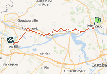
4-Moissac-Auvillar 22km

thonyc
User GUIDE

Length
22 km

Max alt
185 m

Uphill gradient
437 m
Km-Effort
28 km

Min alt
55 m

Downhill gradient
392 m
Boucle
No
Creation date :
2023-05-13 06:22:44.36
Updated on :
2023-05-18 15:42:28.469
6h17
Difficulty : Medium

FREE GPS app for hiking
 SityTrail
IGN / Geographical institutes
SityTrail Plus
The world is yours!
About
Trail Walking of 22 km to be discovered at Occitania, Tarn-et-Garonne, Moissac. This trail is proposed by thonyc.
Positioning
Country:
France
Region :
Occitania
Department/Province :
Tarn-et-Garonne
Municipality :
Moissac
Location:
Unknown
Start:(Dec)
Start:(UTM)
346537 ; 4885051 (31T) N.
Comments