


2023-05-14_19h00m06_La_colline_de_Chalancon_depuis_Mercuer

Linerou
User
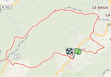

Length
6.6 km

Max alt
520 m

Uphill gradient
282 m
Km-Effort
10.3 km

Min alt
269 m

Downhill gradient
281 m
Boucle
Yes
Creation date :
2023-05-14 17:00:06.156
Updated on :
2023-12-31 10:33:29.237
2h20
Difficulty : Medium

FREE GPS app for hiking
 SityTrail
IGN / Geographical institutes
SityTrail Plus
The world is yours!
About
Trail Walking of 6.6 km to be discovered at Auvergne-Rhône-Alpes, Ardèche, Mercuer. This trail is proposed by Linerou.
Positioning
Country:
France
Region :
Auvergne-Rhône-Alpes
Department/Province :
Ardèche
Municipality :
Mercuer
Location:
Unknown
Start:(Dec)
Start:(UTM)
607811 ; 4942859 (31T) N.
Comments