


Ronde des berges Gragnagne

tabouelle
User
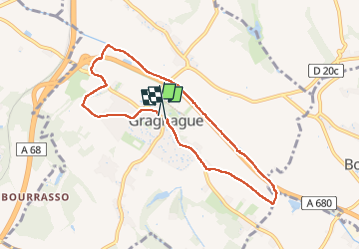

Length
8 km

Max alt
155 m

Uphill gradient
46 m
Km-Effort
8.6 km

Min alt
136 m

Downhill gradient
48 m
Boucle
Yes
Creation date :
2023-05-17 07:56:45.443
Updated on :
2023-05-17 10:36:04.228
2h38
Difficulty : Easy

FREE GPS app for hiking
 SityTrail
IGN / Geographical institutes
SityTrail Plus
The world is yours!
About
Trail Walking of 8 km to be discovered at Occitania, Haute-Garonne, Gragnague. This trail is proposed by tabouelle.
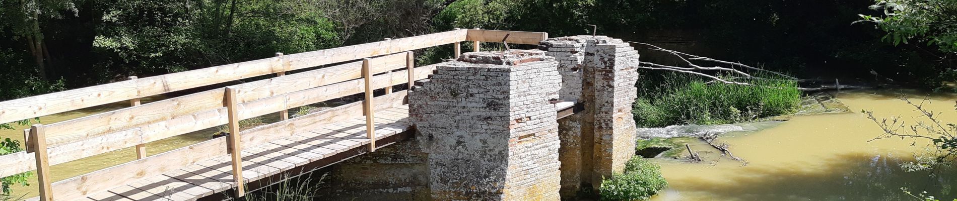
Photos


Positioning
Country:
France
Region :
Occitania
Department/Province :
Haute-Garonne
Municipality :
Gragnague
Location:
Unknown
Start:(Dec)
Start:(UTM)
385780 ; 4837591 (31T) N.
Comments