


voies du canal entre Hesse et Niderviller par Sarrebourg

Titinechris
User
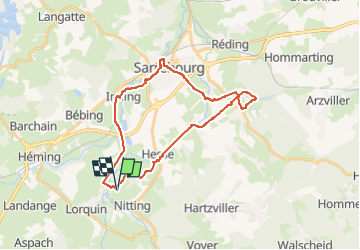

Length
27 km

Max alt
285 m

Uphill gradient
231 m
Km-Effort
30 km

Min alt
245 m

Downhill gradient
234 m
Boucle
Yes
Creation date :
2023-05-17 16:13:51.772
Updated on :
2023-05-17 16:14:47.077
0m
Difficulty : Very easy

FREE GPS app for hiking
 SityTrail
IGN / Geographical institutes
SityTrail Plus
The world is yours!
About
Trail Running of 27 km to be discovered at Grand Est, Moselle, Hermelange. This trail is proposed by Titinechris.
Positioning
Country:
France
Region :
Grand Est
Department/Province :
Moselle
Municipality :
Hermelange
Location:
Unknown
Start:(Dec)
Start:(UTM)
354306 ; 5393613 (32U) N.
Comments