


D'Etréchy à Saint Chéron

jpcccb
User
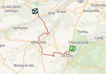

Length
17.4 km

Max alt
157 m

Uphill gradient
322 m
Km-Effort
22 km

Min alt
65 m

Downhill gradient
329 m
Boucle
No
Creation date :
2023-05-20 13:32:46.769
Updated on :
2023-05-20 13:33:31.69
4h55
Difficulty : Very difficult

FREE GPS app for hiking
 SityTrail
IGN / Geographical institutes
SityTrail Plus
The world is yours!
About
Trail Walking of 17.4 km to be discovered at Ile-de-France, Essonne, Étréchy. This trail is proposed by jpcccb.
Positioning
Country:
France
Region :
Ile-de-France
Department/Province :
Essonne
Municipality :
Étréchy
Location:
Unknown
Start:(Dec)
Start:(UTM)
440443 ; 5371507 (31U) N.
Comments