


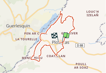
Autour de Plougras, abord de Guerlesquin

ollivier.albert
User

Length
8.7 km

Max alt
244 m

Uphill gradient
125 m
Km-Effort
10.4 km

Min alt
172 m

Downhill gradient
126 m
Boucle
Yes
Creation date :
2023-05-21 13:48:16.258
Updated on :
2023-05-21 16:15:52.688
2h05
Difficulty : Easy

FREE GPS app for hiking
 SityTrail
IGN / Geographical institutes
SityTrail Plus
The world is yours!
About
Trail Walking of 8.7 km to be discovered at Brittany, Côtes-d'Armor, Plougras. This trail is proposed by ollivier.albert.
Description
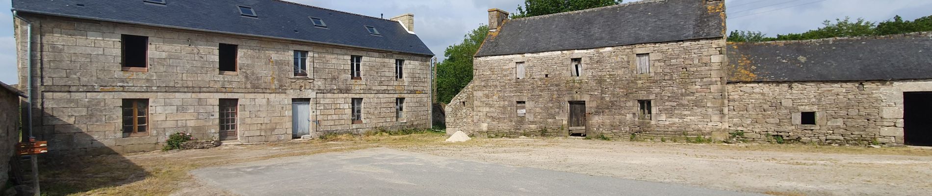
Belle rando avec nombreux sous-bois et panoramas magnifiques sur lesvallées environnantes
Photos


Positioning
Country:
France
Region :
Brittany
Department/Province :
Côtes-d'Armor
Municipality :
Plougras
Location:
Unknown
Start:(Dec)
Start:(UTM)
458468 ; 5373269 (30U) N.
Comments