


Château double

raygautier
User
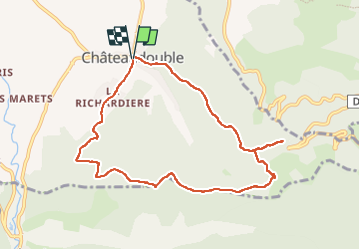

Length
9.2 km

Max alt
782 m

Uphill gradient
525 m
Km-Effort
16.3 km

Min alt
375 m

Downhill gradient
536 m
Boucle
Yes
Creation date :
2023-05-22 08:29:39.0
Updated on :
2023-05-22 13:02:54.681
4h32
Difficulty : Difficult

FREE GPS app for hiking
 SityTrail
IGN / Geographical institutes
SityTrail Plus
The world is yours!
About
Trail Walking of 9.2 km to be discovered at Auvergne-Rhône-Alpes, Drôme, Châteaudouble. This trail is proposed by raygautier.
Positioning
Country:
France
Region :
Auvergne-Rhône-Alpes
Department/Province :
Drôme
Municipality :
Châteaudouble
Location:
Unknown
Start:(Dec)
Start:(UTM)
665498 ; 4973910 (31T) N.
Comments
très bien