


Mont St Quentin

PhilippeC54
User

Length
86 km

Max alt
340 m

Uphill gradient
964 m
Km-Effort
98 km

Min alt
162 m

Downhill gradient
965 m
Boucle
Yes
Creation date :
2023-05-23 06:23:53.09
Updated on :
2023-05-23 10:09:13.906
3h32
Difficulty : Medium

FREE GPS app for hiking
 SityTrail
IGN / Geographical institutes
SityTrail Plus
The world is yours!
About
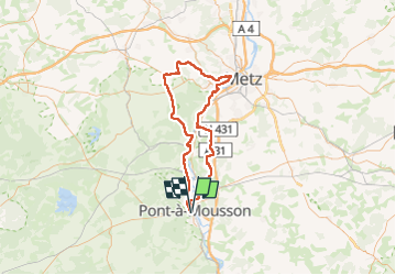
Trail Road bike of 86 km to be discovered at Grand Est, Meurthe-et-Moselle, Pont-à-Mousson. This trail is proposed by PhilippeC54.
Positioning
Country:
France
Region :
Grand Est
Department/Province :
Meurthe-et-Moselle
Municipality :
Pont-à-Mousson
Location:
Unknown
Start:(Dec)
Start:(UTM)
283580 ; 5420453 (32U) N.
Comments