


Serre de jupes

raygautier
User
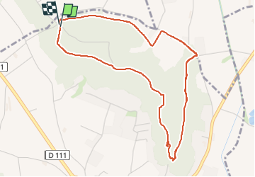

Length
6.6 km

Max alt
255 m

Uphill gradient
125 m
Km-Effort
8.2 km

Min alt
169 m

Downhill gradient
129 m
Boucle
Yes
Creation date :
2023-05-24 07:18:24.0
Updated on :
2023-05-24 09:48:02.252
2h29
Difficulty : Medium

FREE GPS app for hiking
 SityTrail
IGN / Geographical institutes
SityTrail Plus
The world is yours!
About
Trail Walking of 6.6 km to be discovered at Auvergne-Rhône-Alpes, Drôme, Montoison. This trail is proposed by raygautier.
Positioning
Country:
France
Region :
Auvergne-Rhône-Alpes
Department/Province :
Drôme
Municipality :
Montoison
Location:
Unknown
Start:(Dec)
Start:(UTM)
652791 ; 4964503 (31T) N.
Comments