


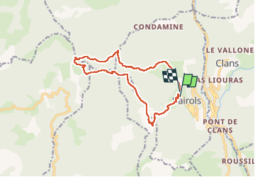
pointe de 4 cantons- Bayrols

franquen
User

Length
15.1 km

Max alt
1791 m

Uphill gradient
1198 m
Km-Effort
31 km

Min alt
827 m

Downhill gradient
1113 m
Boucle
No
Creation date :
2023-05-24 07:50:12.493
Updated on :
2023-05-24 20:03:45.705
7h00
Difficulty : Difficult

FREE GPS app for hiking
 SityTrail
IGN / Geographical institutes
SityTrail Plus
The world is yours!
About
Trail Walking of 15.1 km to be discovered at Provence-Alpes-Côte d'Azur, Maritime Alps, Bairols. This trail is proposed by franquen.
Description
le passage dans la ravine au col de la Courbaissse est particulièrement périlleux, nous avons préféré remonter sur 30 m et récupérer le sentier plus loin.
rando déstnée à des gens entrainés
Positioning
Country:
France
Region :
Provence-Alpes-Côte d'Azur
Department/Province :
Maritime Alps
Municipality :
Bairols
Location:
Unknown
Start:(Dec)
Start:(UTM)
349609 ; 4871721 (32T) N.
Comments