


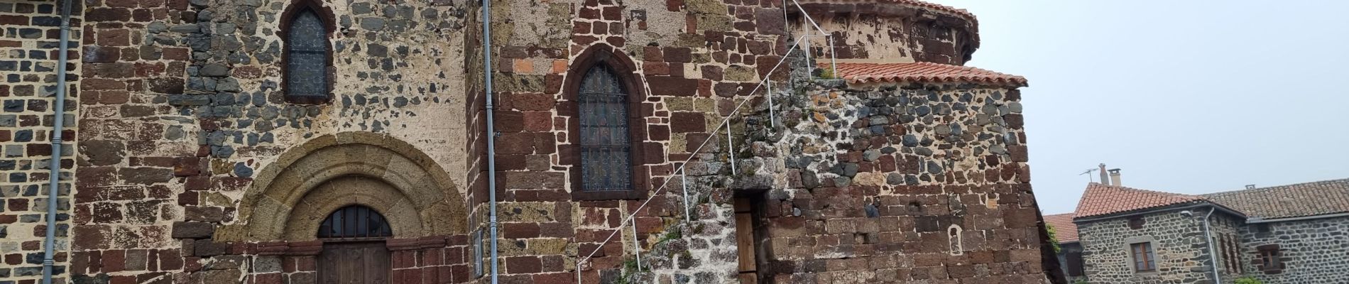
Alleyras

CDSM 55
User
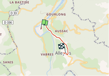

Length
3.1 km

Max alt
790 m

Uphill gradient
157 m
Km-Effort
4.8 km

Min alt
651 m

Downhill gradient
38 m
Boucle
No
Creation date :
2023-05-24 09:15:19.203
Updated on :
2023-05-25 09:30:52.236
35m
Difficulty : Easy

FREE GPS app for hiking
 SityTrail
IGN / Geographical institutes
SityTrail Plus
The world is yours!
About
Trail Walking of 3.1 km to be discovered at Auvergne-Rhône-Alpes, Haute-Loire, Alleyras. This trail is proposed by CDSM 55.
Photos


Positioning
Country:
France
Region :
Auvergne-Rhône-Alpes
Department/Province :
Haute-Loire
Municipality :
Alleyras
Location:
Unknown
Start:(Dec)
Start:(UTM)
552795 ; 4973781 (31T) N.
Comments