


Vallées 2

CDSM 55
User

Length
5.3 km

Max alt
791 m

Uphill gradient
176 m
Km-Effort
7.7 km

Min alt
654 m

Downhill gradient
179 m
Boucle
Yes
Creation date :
2023-05-25 07:26:50.528
Updated on :
2023-05-25 17:14:12.574
1h30
Difficulty : Easy

FREE GPS app for hiking
 SityTrail
IGN / Geographical institutes
SityTrail Plus
The world is yours!
About
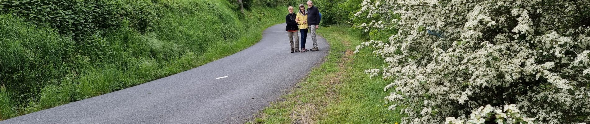
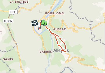
Trail Walking of 5.3 km to be discovered at Auvergne-Rhône-Alpes, Haute-Loire, Alleyras. This trail is proposed by CDSM 55.
Photos


Positioning
Country:
France
Region :
Auvergne-Rhône-Alpes
Department/Province :
Haute-Loire
Municipality :
Alleyras
Location:
Unknown
Start:(Dec)
Start:(UTM)
552814 ; 4973705 (31T) N.
Comments